All Posts
31 posts, newest first.
-
Importance of project notes - NEPA Trails Map terrain
Documenting your mapping process is really helpful. These days, I have a 6x9" book layout in Affinity Publisher. It acts like a hard copy cookbook for map making. In this, I note the programs, files, processes, and thoughts. This post is referenced in my note...
-
Accessing Montgomery County, PA GIS Data in QGIS
This is an overview for community leaders in Jenkintown. They need to be aware of the opportunities to use open source tools to answer questions.
-
Creating a map to show where Kabul is
The map in this video could have been done completely in QGIS. But by exporting the map as a PDF and bringing it into Affinity Designer, which I do around minute 24, I can show how the editing can continue in a graphics program.
-
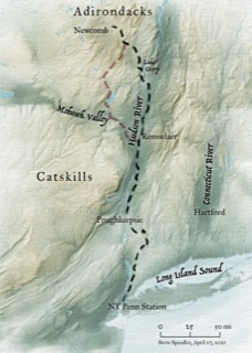
A quick note about this site...
Recently, I have been creating video tutorials that are on Avenza's blog. Avenza makes software that I use every day, MAPublisher. And some of my clients use the Avenza Maps store to share their maps. Avenza's support team has been responsive to questions o...
-
Georeferencing PennPilot aerial imagery
This video covers my approach to georeferencing old aerial photos as I work on a series of Horse-Shoe Trail Maps (a personal project). Key points include using a similar period USGS Quad as a reference, using the index to select an aerial for an area, and crop...
-
Accessing Pennsylvania contours from PostGIS (on a Mac)
This video demonstrates how I access contours for Pennsylvania topography from a PostGIS database in both MAPublisher and QGIS, Compiling the data took an hour to setup, but it's a good time saver. I discussed setting up PostGIS and Postgres on a Mac in a pr...
-
PostGIS with MAPublisher and QGIS
This is a personal note-to-self more than a "how to". Using PostGIS on a Mac seems easier than it used to. Installation of Postgres is straight forward using the installer and instructions available from postgresapp.com, and managing the data using pgAdmin wor...
-
Thoughts on creating a map style sheet
Why create a style sheet? With several inset maps, it helps to create a stylesheet that I can reference for consistency. This could be done as an Illustrator template or as a specific visual document.
-
Converting a divided highway to a single stroke in Illustrator
Because there is no obvious way to merge two parallel lines into a single line in Adobe Illustrator, I needed to come up with a way to do this that doesn't involve redrawing lots of lines with the pen tool.
-
Erie Canal multi-panel map series - project file structure
When I set up the Bicycling the Erie Canal Guide in QGIS, I thought I'd do the whole map in QGIS. I thought I could export the panels as an atlas. But it didn't make sense.
-
Adding mile markers as symbols
MAPublisher used within Adobe Illustrator enables us to create mile markers or other points along a line. I'm using this tool while working on the Genesee Valley Greenway map, and this video walks through the process.
-
Creating guides for a map brochure in Creative Cloud or Affinity Suite
I'll be going over page setup for a 24x12" trail map brochure.
-
A world locator map in 5 minutes using QGIS
A small locator map is fun to make and useful when you want to direct someone's attention to a place in the world that you are trying to describe. It uses an orthographic projection,which looks like you are looking at the earth from a distance.
-
QGIS - Add State Plane (NAD 83) Boundaries from ArcGIS.com
If you are looking for GIS data, the easiest place to find it may be the ArcGIS server. The url shows up in a google search for State Plane (NAD 83). I'd expect the boundaries to be available from data.gov. But when I tried, none of the links worked.
-
QGIS - Show photo directions using wedges
Here are instructions to add photos with directions. You could create wedge point styles that you apply, like in the images below. In the video I'm creating something simple from scratch. Incorporating the Wedge into the style means you can save it for use...
-
Planning my Congressional Map series
In this video, I'm exploring what it takes to repurpose one Congressional District map that I made to work for other districts. It's not very exciting. It just documents how I'm working.
-
Importing Zip Codes to Google sheets, Excel, Numbers and QGIS
ZIP codes produce problems for many people who are setting up a map in QGIS or Excel. I'm going to focus on the missing "0" when importing a CSV file into QGIS or Excel. The frustration people feel about this is totally warranted.
-
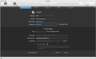
Data Management - Using Tiger, OSM, etc. in QGIS
Open Street Map, TIGER data, catalog.data.gov, state government and regional (MPO) data are all very useful to me. I pondered data as topic as I looked at the following error on the Census website.
-
Creating a SVG road symbol
This video goes over how to create a custom SVG symbol for use in QGIS. This approach would would for creating your own icons. I will be using an image from a PDF that I downloaded at https://mutcd.fhwa.dot.gov/SHSe/Guide.pdf
-
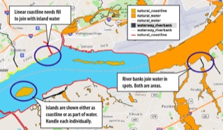
QGIS - Creating a water layer using QuickOSM
This shows how to Create a water layer in QGIS using Open Street Map data using Quick OSM. If you’ve ever struggled with displaying water, I hope you will find the following process helpful.
-
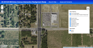
Convert MrSID to Geotif on a Mac to place in Mapbox Studio
When integrating a Mapbox studio map into a WikiMapping project, I was asked, “There’s a store there now. Can you use newer imagery?” And I was given a MrSID file with the newer image.
-
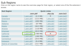
Converting a pbf downloaded from Geofabrik
While it might make sense to convert a pbf into a postgis database using something like OSM2pgsql, I often just want to convert a pbf file to a spatialite file.
-
Week One - Process
You should know that this isn't a GIS class, per say. It's about presenting your GIS maps to an audience. Still, you need to know how to use GIS and may not be familiar with QGIS.
-
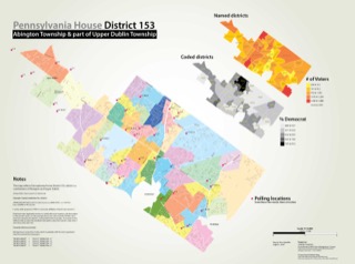
Growth, understanding and sharing through cartography
Maps, whether they are in our head or in some physical form, help us make sense of the space. A mental map might be a combination of landmarks in your head. A physical map might show relationships based on measurements of time, distance, size or quantities.
-
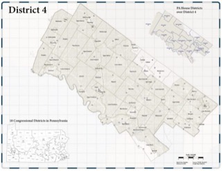
PA District 4 Congressional Map
Pennsylania recently went through a redistricting process. This is important for Montgomery County because District 4 is very similar in shape to the county. There's a bit cut out, and there's a bit of Berks County included.
-
Tompkins County Relief background in QGIS
In my previous post, I created terrain for the Tompkins County map in Natural Scene Designer. Then I imported the terrain into Illustrator using MAPublisher.
-
Do map styles need CASE queries?
While working on a map of Tompkins County, I considered creating new fields for calculations using CASE and IF_CASE. It was just extra work. I figured I could create a single text query that is easier to edit that using a graphical interface.
-
My video-blog strategy
Over the last several months, I’ve documented much of my work via video. Most of these videos get archived in the cloud in case I need to refer to them.